Thursday, May 03, 2007

Road kill, road thrill, road still

Here's what I would have been if I hadn't passed the DMV test: road kill.
The places we go to get all these neat pics
Just a nice on-the-road shot. We've been surrounded by snow-covered mountains for the past three days. Most were in the St. Elias / Wrangell ranges which sort of morph into the Alaska Range that turns north. Denali lies at the end of the AK Range.

FYI

SEWARD, AK - - We've been out of internet range for the past two days during travel from Tok to Palmer, AK and then on to where we are now: Seward for a couple of days of R&R before starting work in Denali.
One of the requirements of working as a driver/guide is that you have to have an Alaskan CLD (commercial driver license). So we had to 'trade in' our Florida license for the AK version. This requires numerous pieces of paperwork to prove that you were born, you pay social security and you have a job in AK.
It also requires you to take a (written) test on general driving information. Now, being a realist as opposed to being of the optimist/pessimist classes, I immediately knew I was in trouble. I don't do do tests very well. In school if you flunk a test, no big deal. In real life and especially in the Department of Motor Vehicles if you flunk a test you're in trouble.
So, while knowing I could pass with ease, I also knew I would seize up before I even started. I even asked the individual at the DMV when I could take the test a second time ("The next day, once a day until you pass.") Encouraging. She also said it was easy, no sweat. Sweat. That was another thing I could worry about.
The test was 20 questions on a computer screen, multiple choice, with illustrations. All you need is 16 right and you pass.
Questions 1 & 2, no problem. Question 3, WRONG. Question 4, WRONG. 18 questions to go and I was already deep in the hole with the water rising fast. Question 5 & 6, no problem. Question 7, WRONG.
Now, the pressure is really on. you end up questioning yourself time and again before hitting the touch screen on the answer you hoping against all else is correct. Each time I touched the screen my heart rate went up, my blood pressure went up, the air seemed to be sucked out of the room and I could feel the eyes of everyone on me.
I got questions 8-13 correct. I'm on a roll, but it feels like I'm trying to outrun a huge boulder rolling downhill faster and faster. Questions 14, 15, 16, 17; all correct. I have the feeling that this is what playing Russian Roulette is like and that the bullet with my number is about to come up.
I get questions 18 and 19 correct. The screen says: "congratulations, you've passed." I turn and give Lydia a shaky thumbs-up and walk away from the machine not so much with a sign of relief but more the feeling of one who has nearly gone under for the last time buy was lucky enough to get that one last breath to make it to shore.
Funny thing, the questions weren't hard, but sometimes I certainly have the ability to pile the pressure on. Survived Again.

Monday, April 30, 2007

2 moosies

ALONG THE ALASKA HIGHWAY - - We're still going through pictures we took while we were out of internet range. This mother moose sheltered her youngster while we patiently waited for her to move enough to get a shot showing a bit more of the two. No such luck.
UPDATE: The feline referred to as Pico in the previous blog is really Peeko. I probably made the same mistake last year too.

Sunday, April 29, 2007

The usual suspects


WHITEHORSE, YUKON TERRITORY - - We've been out of wi-fi territory for a bit so this is a catch up. Firstly, we've stopped in Whitehorse, a town of 22,000, which we got to know quite well last summer as it was our escape valve from Skagway. We're staying in our favorite (indoor) place: a hostel called Hyde-On-Jeckll. So picture 1 is of the welcoming committee - - Pico the cat, who, we would like to think, remembered us from previous stays. The real reason is probably the sunbeam-warmed blanket on the end of the bed that the she immmediately curled up on.
Leaving from Liard Hot Springs Lodge this morning we encountered several groupings of wood buffalo. This not-too-friendly fellow in Picture #2 stood by the side of the Alaska Highway eyeing us but fortunately not moving. Last year on our way North we saw a total of one buffalo. This year we have lots of buffalo in lots of pics.
On the way to Liard from The Shepherds Inn we encountered these fluffy fellows (Pic #3) who looked like their coats had been blow-dried. They are stone sheep and are rather scarce unlike their more viewed cousins, the mountain sheep variety. More later.

Friday, April 27, 2007

Alaska Highway, Mile 72

SHEPHERDS INN - - On a road like the Alaska Highway with towns, settlements and small groups of houses along the way it's better to have a mile-marker as your address. And so, here we are at Mile 72 and the Shepherds Inn. This is a slightly rustic motel and gas station about 20 miles from the 'real' civilization of Fort St. John.
The deal here is that everyone is made to feel at home by the nice folks who run the place. You find that out along the route as tourists and work crews and locals are the lifeblood of staying solvent. The economy in this general area is based on oil/gas/timber so having those folks know that home made pies/baked goods and good coffee are available plus plenty on the plate of whatever you order makes this place quite popular.
I called to check on making a reservation when we were three hours away. "Do you need a credit card for the reservation," I asked. "No, just give me your name and I'll see you when you get here," was the friendly reply from the manager. And that's the way it was.
No pics today on my blog because the only live animals I might have taken pics of were white-tail and mule deer. Now I did get a chance to see lots of skeletons and half decayed bodies of elk and (we think) some moose as well but they weren't very photogenic. Animals killed in winter get plowed to the side of the road along with the snow and don't show up until things begin to melt.
And for today's brain teaser: Why do they call it the Alaska Highway if 75% of the route is in Canada??

Wednesday, April 25, 2007

Asleep at the wheel

JASPER, ALBERTA - - Most folks in northern Canada and Alaska have dogs. Some are guard dogs, some are watch dogs and some are slackers. This guy has obviously figured it out that his master won't be back for awhile and he's grabbing some sack time...asleep on the wheel.

Don't mess with me

JASPER, ALBERTA - - This female elk kept us amused as we ate dinner. She was foraging across the street from the restaurant and didn't want to be bothered. We saw three individuals walking / jogging along the sidewalk nearby and she mock-charged them all. I got close enough with my 200mm lens to be safe and still get a bit of the evil eye. A freight train is parked on the railroad tracks behind.

What I want to be when I grow up

COLUMBIA ICE FIELDS VISITOR CENTER, BETWEEN LAKE LOUISE AND JASPER

Now this is a BUS! As you can see by the relative size of our Honda Element versus the Glacier Bus the Element needs a to start eating Wheaties. The custom-made bus fleet are outfitted with huge tires with tractor-style lugs to better grip the ice/show of the Columbia Glacier. Right, you ride the bus to the glacier and then out onto the glacier. But there were no busses running today - - because it isn't tourist season yet. Although you can't see it in the picture a snow squall was blowing hard across the glacier on the other side of the road. It was that sort of day on our drive up the Ice Fields Parkway, a 142 mile spectacular route through the Canadian Rockies...snow, grey skies, visually fantastic but hard to pick up the feeling with a camera.

Monday, April 23, 2007

History lesson

BOW VALLEY PARKWAY - - This statue in a remote area along the Bow Valley Parkway honors the Ukrainians who were interred in a camp there during World War I (1915-17). This is but one of many camps in Alberta and other locations in Canada where refugees from the Baltic States were sent...much the same way Japanese individuals in the U. S. during World War II were sent to interrment camps.
We've passed the memorial numerous times in the past six years and there were always flowers or decorations or loose change (on the pedestal at the area around the right foot) or other items to show that despite the remote location people stop and think and care.

slim pickin's

BOW VALLEY PARKWAY, NEAR LAKE LOUISE, ALBERTA - - This was just one of three youngsters scratching for anything green alongside the roadway. The males in the group were on top of a ridge just above where there was more grass. With warming temperatures and the snow thawing, the amimals move toward the roadsides where the dormant grasses sprout first.

Taking it easy

BANFF, ALBERTA - - Some days you just have to relax and take it easy. Here we are slacking off at a view point along the bow river. Sun, snow, sweet time.

Sunday, April 22, 2007

Rocky times ahead

CANMORE, AB - - Gone are the days of grain fields waiting to be sown and beef cattle grazing on spreads that stretch as far as the eye can see. Now we're into what we really travel for: high snow-covered mountains; fresh cold air and people roaming around in hiking boots and heavy jackets.
The Trans-Canada Highway from Moose Jaw to Canmore went from flat lands to rolling hills to a countryside covered with snow and back again to no snow on the ground but plenty on the Canadian Rockies. We can look out the window of the Mountain View Inn, where we are staying tonight, and see part of the Three Sisters Peak - - one of the easier peaks to identify here.
Canmore, along with Banff and Lake Louise, is an area in transition: there's enough snow to keep the ski slopes open until at least the beginning of May, but there's also a hustle on in the businesses to change from winter to summer tourist mind-set.

Saturday, April 21, 2007

Photos?

MOOSE JAW, SASKATCHEWAN - No I haven't forgotten to post pictures...just haven't seen much of anything interesting yet. There were lots of big grain elevators in our ride from Jamestown, ND to here along with fog and some rain. We had pheasants on the side of the road, Canada geese, mallard ducks, lots of dead deer and some unidentified road kill but only the pheasants were photogenic and you can't stop in time to get a shot. Check Lydia's blog for one interesting spot we did stop.
Now that we're in Canada the scenery should pick up as we head to Banff and Lake Louise.

Friday, April 20, 2007

Fargo North, decoder

JAMESTOWN, ND - - Actually we passed Fargo, ND 100 miles back on our way here. Jamestown is a small burg on I-94 about halfway between Fargo and Bismark. Tomorrow, we head off-Interstate and drive up scenic(?) SR 52 to the Canadian border at Portal, ND. and head toward our target town for Saturday night - - Moose Jaw, Saskatchawan.
For those of you who might wonder what ND is like...it's like, flat and windy and as we look out the Super 8 Motel window, it's gathering up nasty, dark clouds and raining.
One plus: the I-94 speed limit is 75...and the wind was gusting to 40mph. Unfortunately, it was a side wind or we would have rigged the sails and gotten really good gas mileage.
On our way through Minneapolis we stopped at our favorite REI store and spent 70 minutes there...at a cost of $4 per minute.
Monday, April 16, 2007

Alaska, one more time

Ann Arbor, MI
April 16

1,000 miles behind us and, from looking at road signs, we've nearly been around the world. Places like London, Paris, Rome have all flown past...of course it was the interstate and we were rolling from our Ormond Beach home to see friends in Michigan. Two days of being blown around on the interstate makes a day off just to stroll around Ann Arbor very worth while. And then it's on toward Wisconsin, North Dakota, Canada and on and on.
We've been honing our wildlife spotting skills by picking out gas prices on station signs just off the interstate...at 60+ miles per hour. We started out in shorts and by the time we got to Atlanta it was cool enough for jeans not to mention the 30mph winds. We actually changed the route of the early part of the trip because of the wind/rain/thunderstorms/hail which would have made driving on our initial route to/thru the Carolinas pretty nasty.
There aren't too many adventures in the Heartland, but we're looking.

Friday, April 13, 2007

Short timers

April 13
It's that time..well, almost. We hit the road for Alaska on Sunday. This time we should clock close to 5,500 miles on our way to Denali National Park. The trip will include a couple of stops at the homes of some friends and a lot of interstate pavement we've seen before and some we've not. Then it's into Canada and Banff and Jasper and Dawson Creek which is Mile Zero and the starting point of the Alaska Highway. 1,100 miles later we pass through Kluane National Park in Canada's Yukon Territory and from there on to Anchorage and then Denali it will be all new territory we are covering.
We're ready. We're almost packed but can probably stuff a few more things into our (faithful) Honda Element. And the cats?? To put it mildly....they ain't happy that something is going on. Sort of like traumatic stress syndrome, kitty style.

Sunday, March 18, 2007

Don't go in the water

Merrit Island National Wildlife Refuge
March 18,2007
This medium-sized alligator is having a sunbath. The operative of these reptiles to warm up in the sun while trying to lull any unsuspecting bird / fish / animal close enough to become a lunchtime snack. The gator appears to already be well fed and, fortunately, is facing in the direction away from us. The photo was taken from a slight uphill location with a telephoto lens. If this critter was really hungry then we were probably not far enough away to be definitely safe if the creature should decide to make a mad dash for the crowd of adults and children watching.
Check Lydia's blog on my links section for a couple of other critters spotted on our Sunday sojourn.

Saturday, March 17, 2007

The adventure continues

March, 17, 2007

We're at it again. After over 2 months of checking on-line job sites; sending resumes and lots of waiting Lydia and I secured jobs in Alaska's Denali National Park. The park is larger in land area than the state of Massachusets and home to a wide variety of wildlife - - other than the park workers. It is home to Mt. McKinley (20,230'), the highest mountain in North America.

We'll be doing similiar jobs to what we did last year in Skagway, AK...hearding tourists and filling their brains with facts, information and personal tales of glory and hardship from the land of the seasonal summer worker. Of course, we get to preface out stories with "retired." Stay tuned as the adventure continues.

Thursday, February 22, 2007

The finish line

If you read my Feb. 10 blog on The Yukon Quest sled dog race then you'll know that we had a friend in the competition. Michelle Phillips, who we met during our summer gig, finished sixth in the competition. She finished the 1,000 mile race from Whitehorse, Yukon Territory, Canada to Fairbanks, Alaska on Tuesday at 1pm. The temperature at the finish was -25.

The sixth place finish was a family best as the previous highest finish for both Michelle and her husband, Ed, was eighth. Check out www.yukonquest.org; the official race site; click on race photos and go to the Pelly Crossing series. About 16 pics in is a photo of a frosted Michelle with pic 16 one of her and her dog team. check it out.

Saturday, February 10, 2007

Race time

It was 8-degrees today in Whitehorse, Yukon Territory. This is only important if you were on the starting line for the 1000-mile Yukon Quest dog sled race. Lydia and I have a friend in the event, Michelle Phillips. She, along with companion Ed, ran the dog sled rides and Alaskan Husky puppy petting portion of our favorite tour destination, Caribou Crossing.
The race goes from Whitehorse, YT to Fairbanks, AK. The race is not as well known as the Iditarod (which is completely in Alaska) and doesn't have the big prize money, but it is tougher and harder with only 8 check points in 1,000 miles - - which means that there is one spot where it is nearly 200 miles between check points and for at least 2 full days it's just you and the wilderness. Interesting fact: the most dangerous thing on the trail aside from freezing to death or crashing and losing your grip on the sled (which means the dogs just keep on running away from you) is being charged by a moose. Now, moose are magnificent animals - - they just have really lousy eyesight.
Now, if you are interested in how the race is going or want to find out some interesting info check out yukonquest.org. This is the official web site. Another web site, run by someone who we have never met but have used it extensively for information and just to see how things are way up north near Skagway is explorenorth.com

Monday, December 18, 2006

Tis the season

ORMOND BEACH, FL
December 18, 2006
The christmas lights look pretty good at 8pm. The blue light christmas tree is set up on a float just off the fishing pier/walk at the bridge. This year the city decided to kick it up a notch and get some BLUE lights not the pastel sky blue lights of past years. This makes the trees - - there are four on the water - - have neat relections in the water.

Just down the street from the house is a yard with a lot of decorations including this santa with his sleigh and (a couple of) reindeer.

The pics probably look better if you squint a bit and have the lights off.

Lazy Daze

ORMOND BEACH, FL
December 18, 2006
What have I been doing lately??? Not too much since I don't fish or play golf ... sort of like the snowy egret strolling on the pier/walk four blocks from our house. Mostly, I've been watching Lydia take egret pics like the one above which she shot before we left for Alaska at the beginning of summer.

Actually, the most interesting thing to do is something we got into over the summer. In Skagway it was watch the cruise ships and ferry boats come and go. Here, in Ormond, we get to watch the lifestyles of the rich and richer as their hired crews - - in sailboats and cabin cruisers migrate south on the intracoastal waterway heading to Palm Beach, Miami, The Keys and the Carribean or points inbetween.

It's easy to see who has $$ and who has A WHOLE LOT OF $$$$$!!

Saturday, November 18, 2006

ET Update

ORMOND BEACH, FL
November 18, 2006
About six weeks ago I posted a blog on and interesting area we had come across on our trip back from Alaska. Unfortunatlely, I forgot to take photos for the posting ... well, here it is! The pic of the Nevada Dept. of Transportation road sign for the Extraterrestrial Highway. You are probably wondering how I got the pic since we are now home in Ormond. Easy. I phoned up my little green buddies, had them fire up their hyperspace-travel rocketship - - which is sort of shaped like a 'flying saucer' - - and zip down to Nevada. Two of the crew, Skipper and Karla, posed by the sign but because they didn't turn off their invisibility shields you'll have to take my word that they are indeed in the photo.
Double-click on the photo to blow it up and check out all the stickers, etc. that real human beings - - and maybe a few intergalactic travelers - - left behind.

Monday, November 06, 2006

Not seen in Ormond Beach

ORMOND BEACH, FL Nov. 6, 2006
Things you don't see in Ormond Beach: It's amazing what you see the second or third time you scroll thru the pics taken while in Alaska/Yukon Territory. Sometimes you find the jewels of an area when it's too late to really take advantage. Here's a pic of Blogger Lydia. It was raining with a cold wind, the grass was wet and so were our shoes; the trailhead was somewhere down along the ribbon of road near the lake and it was one of our favorite hikes. Imagine what it would have like in sunshine.

Monday, October 23, 2006

Welcome Home committee

ORMOND BEACH, FL, Oct. 22, 2006
We're home. After six and a half months we weren't sure if the cats would recognize us. Our housesitter, who admitted he wasn't exactly a cat-person, had adapted and said the felines were doing fine.
We opened the door to find the welcoming committee of the Princess (above) who is always mellow and the Queen (below) who wasn't quite as thrilled with us leaving her. Anyway, Princess follows me all around the house and climbs into my lap when I sit down. The Queen makes her displeasure know whenever Lydia enters the area. This was the same sweet disposition we knew and loved before we left - - hoping that absence might make her a bit more "sweet".
Maybe, however, the Queen is just practicing her 'greeting' for all those trick-or-treaters who will come by on Halloween.

Thursday, October 19, 2006

Taking a stroll

GRAND CANYON, AZ
The seldom-seen blogster, Lydia, heading down the trail on a (relatively) short hike on the Bright Angel Trail followed by her faithful sherpa, DoubleEspresso.

Winslow, AZ pics

WINSLOW, AZ
Taking it easy.

Wednesday, October 18, 2006

Take it Easy

SILVER CITY, NM, Oct. 18
This morning we left Williams, AZ and all it's Route 66 glory. We rolled down I-40 @ 75mph looking for a good place to grab breakfast. All it took was a billboard that caught my eye which read: "Come stand on The Corner in Winslow, AZ - - next exit." We pulled off as even my musically-challenged mate related to the Eagles hit "Take it Easy" (Written by Jackson Browne). And, yes, Winslow is also on Rt. 66.
"The Corner" is memorialized with a statue, signage and a mural on a wall behind the statue. Closer inspection revealed that it is indeed a wall as the rest of the building which used to be connected to it is no longer there. Nostalgia reigns as one store on the adjoining corner was playing the song and we saw at least 20 folks stop to take pictures and have their pictures taken as well -- which we did also - - and share some camaraderie as none were younger than mid-40s that we saw.
Tonight its Wild West time. Silver City, NM, was the birthplace of Billy The Kid, an infamous outlaw whose lore and legend is but one of the many attractions here along with - - you guessed it - - more mining for silver and gold.
Now, where are the pics?? Well, the sort of weak wi-fi signal from the motel next door (which we've just happened to pull in) isn't strong enough to post pics.

Toes over the canyon

GRAND CANYON, AZ, Oct. 17
This pic doesn't really need a lot of explanation. If you looked over the edge it was at least 2,000' straight down and that wasn't even to the valley floor and the Colorado River. So, while my toes are near the edge and I'm reclining on my backpack so I can take the photo I had Lydia hanging onto me just in case.

Monday, October 16, 2006

The Twilight Zone

EAST OF TONOPAH, NV
Head out on U.S. highway 6 from Tonopah and eventually you'll pass Alamo, NV and an intersection with NV375. What I didn't catch on the drive past on the way to Lunar Crater was the signpost for Extraterrestrial Highway - - a real Nevada DOT sign - - which I saw on the way back was peppered with bullet holes and decals. And I didn't think to get our hosts to stop for a pic.
In 1996, due to many reports of UFO sightings on the 98 mile stretch of highway, it was renamed the ET Highway. Not coincidentally, the road parallels a portion of the Groom Lake Base / Nevada Test Site know as "Area 51." This area, which derives its name from being in grid 51 of the location map, is a US Air Force test center and is home to a 6-mile long runway. The U2 spyplane of the 60s; the SR71 Blackbird spyplane and other futuristic aircraft like the Stealth Bomber are either acknowledged or rumored to have tested in the area.
Want to know more?? Google Extraterrestrial Highway and Area 51 for lots of interesting fact and conjecture.
.

Catch up

WILLIAMS, AZ, Oct. 16
So here we are on Route 66 in Williams, AZ. We came through Boulder City, NV earlier today and they also were treading on the mythical stature of days gone past on Route 66. The gas station museum is just one of many buildings in Williams along this stretch of 66 to try to cash in with memorabilia. Actually, we turned off at the wrong I40 exit on our way to the Grand Canyon; saw that the area we were in was pretty neat and decided to spend the night - - the storm clouds rolling in had a bit to do with the decision. And, no, we didn't find any stores selling "kicks on Route 66."
VIRGINIA CITY, NV, Oct. 13
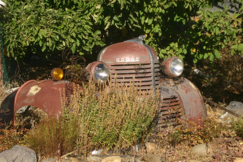
I found this piece of a vintage Dodge truck in Virginia City, NV. The town, like Skagway, has a history shrouded in precious metals - - both silver and gold. And, like the Klondike Gold Rush, also has a famous author tied into the history. Mark Twain started his writing career as a reporter for the (Virginia City) Territorial Enterprise. Today, the former newspaper office is a museum and there is also a Mark Twain Book store. The town's main street has a more rustic appeal than Skagway with casinos and T-shirt/souvenir shops, not jewelry stores, taking most of the attention.
SOUTH LAKE TAHOE, CA, Oct. 12
Just a few miles outside South Lake Tahoe we stopped at a Bureau of Land Management-operated National Forest visitor center. One of the many nature trails led us through an area for bird watching and then to a stream where Kokanee salmon were spawning and the Morganser Ducks (above) were zipping around in formation stalking the fish.
The Kokanee is/are quite famous for (apparently) giving their name to a regional beer here on the Left Coast. Why you would name a beer after a fish is beyond my realm of info.
FYI: The Kokanee have it made. They spawn in nearby stream, the young (fry) swim to Lake Tahoe and then return 3-4 years later to start the circle again.

Wednesday, October 11, 2006

Crescent City Kitty

SOUTH LAKE TAHOE, CA, Oct. 11, 2006
While Lake Tahoe has many areas with docks around the lake this shot is from Crescent city, CA on Oct. 9. We had stopped to take a quick bagel and peanutbutter lunch break and encountered this friendly feline. Lydia had taken a walk to take a pic of the lighthouse there and this guy wandered up, walked across my lap and sat down. The body language was simple: I'm not really wild so pet me and take me home; better yet take me home and feed me. It was obvious from his manners that somebody had abandoned the coal-black critter. Too bad 'cause he had character.
No pics between Susanville, Reno, NV and Tahoe. Just wide open spaces with lots of brown grasses, pine trees and cattle/horses/alpacas/sheep. Tahoe got 6" of snow on Monday, which made the roads slick; there's still some in higher elevations around 6,000'

Tuesday, October 10, 2006

Catching up

SUSANVILLE, CA, Oct. 10
We've turned left from our trip down the Washington / Oregon / California coast and headed into the northern interior of California...sort of Paart Two of our journey back to FL.

Here are a couple of photos to sort of catch things up. until I/we find more that we overlooked the first time. The above pic is from the Redwood National Park area outside Eureka, CA. The pic doesn't really show how tight some of the passages between the trees and the narrowness of the road was.
We stayed in Cape Blanco State Park campground and went out to see the lighthouse at about 7:15am. That's the morning sun glistening off the lower left of the sign and the light (this is still a working light) shining thru the Fresnel lens

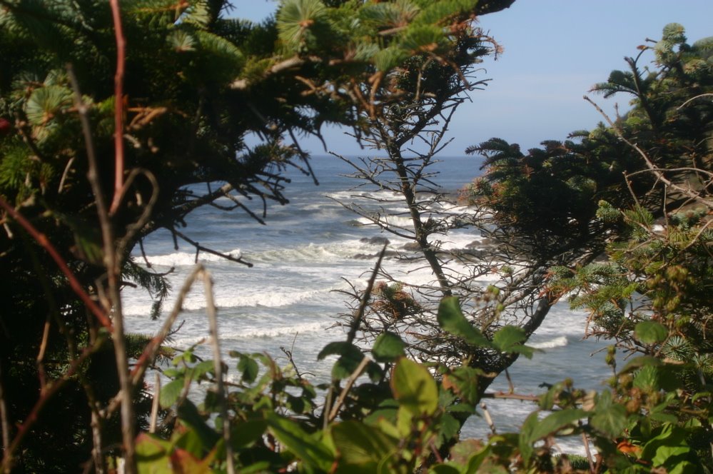
What we have here is a technical glitch which I can't (maybe) figure out how to fix. The two photos are supposed to be centered rather than side by side. Anyway the left (or top) pic is somewhere along the coast while the right (or bottom) shot of the driftwood and reflection in the tidal pool should be from Canon Beach near Seaside, OR

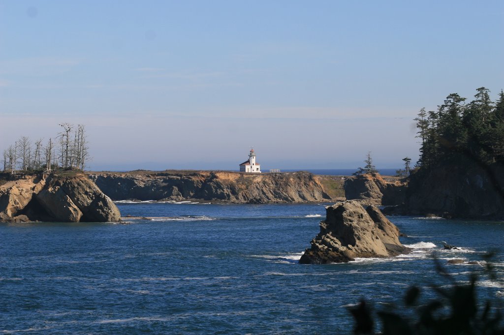
Cape Arago Lighthouse, Charleston, OR

Saturday, October 07, 2006

Making waves2

CAPE PERPETUA, OR
One more shot

Making waves

CAPE PERPETUA, OR
We missed all these sights yesterday due to lousy weather and low clouds. Cape Perpetua has plenty of trails along the ocean with tidal pools, blow holes, driftwood and other spectacular wave induced natural attractions.


Friday, October 06, 2006

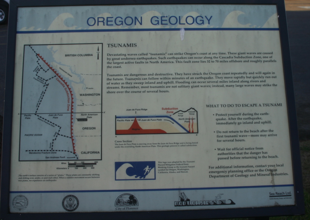
Info


FLORENCE, OR
Click on the pic to get an easier size to read

Sunset

CAPE LOOKOUT (OR) STATE PARK, Oct. 4
I cheated and used a cross-hatch filter on the camera lens to get the 'star' look of the setting sun on the beach area at Cape Lookout. We were camped behind a sand dune nearby. It was comforting to know that they tested the Tsunami Warning sirens in the campground every other Monday of the month. Beautiful Oregon State Parks, great facilities and signs warning you that you are camped in a Tsunami Hazzard Area.
On the plus side, the warning signs say you have approximately 20 minutes from wailing sirens scaring the hell out of you before you should prepare to start swimming.

Wednesday, October 04, 2006

Axe me no questions


JOYCE, WA
Whiskey Creek Beach Campground

This double-headed axe looks quite menacing in the daylight, especially with that short handle. You ought to try it out in the dark, chopping big firewood into smaller pieces. You do this very, very carefully.

Check out lydiahinshaw.blogspot.com for her blog on our stay in a rustic camping cabin. This photo should give you an insight into 'the rest of the story.'

Tuesday, October 03, 2006

Stripes

SEASIDE, OR, 10.3.06
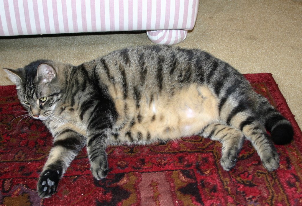
This well fed rascal is the guard kitty in one of the bookstores we wandered through on a walking tour of Seaside. A customer came in just as I was about to get a name for the above fur-ball and then I forgot the name of the store. Still, since the unnamed feline was up for a belly rub or two I decided to make, as the shop owner noted, " doesn't like to miss meals" slightly famous

Where else but on the Left Coast

OLYMPIC NATIONAL PARK (seashore), WA, 10.2.06
SEASIDE, OR, 10.3.06
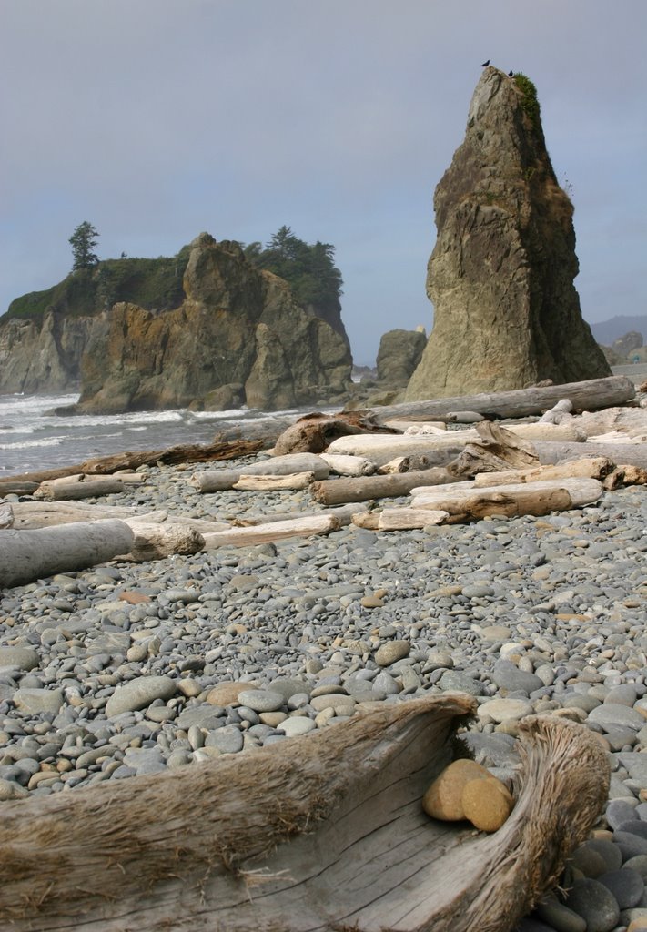
Let's say you're on the beach checking out the driftwood, the rocks, the scenic views when suddenly you feel the ground shaking!! Wow! What should you do?? The states of Washington and Oregon..and maybe California too...have you covered. There are signs near the beaches to tell you that if the ground shakes and you are on the beach to: RUN LIKE HELL!! There are signposts like the one below directing you to Tsunami Evacuation Routes. There are information sheets posted inside rooms in hotels, motels (and the Hostel in Seaside, OR, where we are staying) with lots of good Tsunami info. The same goes for the campground we stayed in last night, which was on the ocean.
So, for those of you who see the glass half-empty or are an optimistic realist like I am -- then if you don't get caught in an avalanche of rocks and trees from above you can bet you'll sleep with the fishes if you don't get to high ground quick enough.
More dispatches to come from the Left Coast as the fun continues.

Monday, October 02, 2006

Safe refuge

SAN JUAN ISLAND, WA

The Bald Eagle perched on the National Wildlife Refuge sign has the perfect location to inspect the kayak-ers on the calm waters of xxxxx as they float by. However, he's more interested on what's going on in the waters on his side of the rocks.

Five months of trying to spot wild animals and birds on the Klondike Highway and surrounding areas wasn't wasted as we spotted this 'baldy' before we even pulled into the park's parking lot. We had rented a car in Friday Harbor, where the ferry docked, to tour the island.

Sunday, October 01, 2006

Book Club

DoubleEspresso Book Club selections:

"The Blue Bear" by Lynn Schooler. This is a very interesting book about friendship and Alaska. Despite the title sounding like a children's book, this is a real life true story.

"Shadow Divers" by Robert Kurson. This is the story of the discovery, in 1991, of a German submarine from WWII in an area off the New Jersey coast where there was no reported U-Boat activity. The obsession to discover the name of the sub and the identity of those aboard and bring closure to the men's families takes nearly 10 years. Another true life tale.

Time for coffee

We're sitting in the aptly-named (for Florida residents) Hurricane Coffee Company in Sequim, Washington. There's another coffee shop across the street and down a-ways, just as I'm sure there is another coffee-shop drive-thru within a mile or two. It's kind of like dying and going to coffee heaven. If I don't pace myself in coffee nirvana I could be wired until we're two states away. I'm quite sure that Oregon - - where we're headed next - - will have almost as many java joints.

Thursday, September 28, 2006

FRASER RIVER VALLEY, BETWEEN QUESNEL AND HOPE, BC
I really wanted to use a dateline listing the towns of Likely and Horsefly but that would have required a 60 mile round trip to check them out. Anyway, the drive from Quesnel to Hope along CA97 parallels the Fraser River Valley and is quite spectacular, especially in sunlight.
The Big Horn Sheep - - and a couple of friends - - spotted us as we headed south. The train shot was taken from a rest area along the road. One nice thing is that on CA97 you have plenty of pull-outs from which to shoot spectacular scenery AND passing lanes every two miles or so. Since the road is very up and down plus quite twisty and the main industry around here is lumber you need to zip around the much slower trucks.
But back to the railroad shot. It seems back in the 1800's when railroad building was the 'in thing' that two competing rail companies built tracks on opposite sides of the river. We actually had trains running in both directions when the shot was taken.
Spending time in a coffee shop in Hope, BC before heading to and across the US border into Washington State and the Pacific Coast Highway.


Wednesday, September 27, 2006

FYI

QUESNEL, BC
We seldom, if ever, have a Big Mac Attack...unless the McDonalds has a billboard sign on the highway advertising free wi-fi. So, for the price of 2 coffees (yes, we're seniors, thank you) we got the net and you're reading the outcome. By the way the town we're in is pronounced Kweh-nell regardless of how it is spelled. Cheers.

Monday, September 25, 2006

SHINE A LIGHT ON THE BEAR, NOTES

ON THE INSIDE PASSAGE HEADING TO PRINCE RUPERT, BC
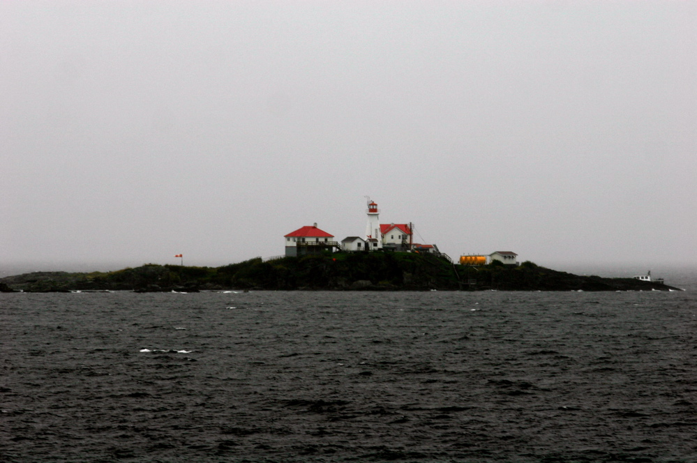
Want to get away from it all?? This lighthouse perched on a rock outcropping somewhere within the Canadian portion of the Inside Passage offers those with a solitary bent the perfect way to spend some time. No neighbors and not much else; maybe not even a way to get off as the boat in the far right of the picture is partially sunk although anchored to what appears to be a dock. ***click on the pic to enlarge it

I've enhanced the colors a bit to make things more recognizeable as this was taken under very foggy conditions, a strong wind and blowing rain.

(BELOW)
The black bear youngster below was out foraging in the grass alongside the Yellowhead Highway as we drove from Prince Rupert, BC to Smithers. It's raining so his/her coat is wet and matted but with a bear this young and no momma bear around we believe that the cub has no one to take care of it. Normally, young cubs spend at least two years with their mother learning how to hunt and survive. This shot was taken as the cub made its way across the highway; fortunately the driver of the lumber truck coming up behind us saw the cub and stopped until it got across and into the bushes. ***Click on the pic and take a look at it full sized.
Today (Monday, 9/25) we're creating blogs from the Smithers Guest House / Hostel in Smithers, BC. Last night it was blog-away from the Black Rock Rooster Hostel in Prince Rupert. We're not sure where we will be tomorrow night but if the rain continues it will be someplace warm and dry rather than a campground.