Monday, December 18, 2006

Tis the season

ORMOND BEACH, FL
December 18, 2006
The christmas lights look pretty good at 8pm. The blue light christmas tree is set up on a float just off the fishing pier/walk at the bridge. This year the city decided to kick it up a notch and get some BLUE lights not the pastel sky blue lights of past years. This makes the trees - - there are four on the water - - have neat relections in the water.

Just down the street from the house is a yard with a lot of decorations including this santa with his sleigh and (a couple of) reindeer.

The pics probably look better if you squint a bit and have the lights off.

Lazy Daze

ORMOND BEACH, FL
December 18, 2006
What have I been doing lately??? Not too much since I don't fish or play golf ... sort of like the snowy egret strolling on the pier/walk four blocks from our house. Mostly, I've been watching Lydia take egret pics like the one above which she shot before we left for Alaska at the beginning of summer.

Actually, the most interesting thing to do is something we got into over the summer. In Skagway it was watch the cruise ships and ferry boats come and go. Here, in Ormond, we get to watch the lifestyles of the rich and richer as their hired crews - - in sailboats and cabin cruisers migrate south on the intracoastal waterway heading to Palm Beach, Miami, The Keys and the Carribean or points inbetween.

It's easy to see who has $$ and who has A WHOLE LOT OF $$$$$!!

Saturday, November 18, 2006

ET Update

ORMOND BEACH, FL
November 18, 2006
About six weeks ago I posted a blog on and interesting area we had come across on our trip back from Alaska. Unfortunatlely, I forgot to take photos for the posting ... well, here it is! The pic of the Nevada Dept. of Transportation road sign for the Extraterrestrial Highway. You are probably wondering how I got the pic since we are now home in Ormond. Easy. I phoned up my little green buddies, had them fire up their hyperspace-travel rocketship - - which is sort of shaped like a 'flying saucer' - - and zip down to Nevada. Two of the crew, Skipper and Karla, posed by the sign but because they didn't turn off their invisibility shields you'll have to take my word that they are indeed in the photo.
Double-click on the photo to blow it up and check out all the stickers, etc. that real human beings - - and maybe a few intergalactic travelers - - left behind.

Monday, November 06, 2006

Not seen in Ormond Beach

ORMOND BEACH, FL Nov. 6, 2006
Things you don't see in Ormond Beach: It's amazing what you see the second or third time you scroll thru the pics taken while in Alaska/Yukon Territory. Sometimes you find the jewels of an area when it's too late to really take advantage. Here's a pic of Blogger Lydia. It was raining with a cold wind, the grass was wet and so were our shoes; the trailhead was somewhere down along the ribbon of road near the lake and it was one of our favorite hikes. Imagine what it would have like in sunshine.

Monday, October 23, 2006

Welcome Home committee

ORMOND BEACH, FL, Oct. 22, 2006
We're home. After six and a half months we weren't sure if the cats would recognize us. Our housesitter, who admitted he wasn't exactly a cat-person, had adapted and said the felines were doing fine.
We opened the door to find the welcoming committee of the Princess (above) who is always mellow and the Queen (below) who wasn't quite as thrilled with us leaving her. Anyway, Princess follows me all around the house and climbs into my lap when I sit down. The Queen makes her displeasure know whenever Lydia enters the area. This was the same sweet disposition we knew and loved before we left - - hoping that absence might make her a bit more "sweet".
Maybe, however, the Queen is just practicing her 'greeting' for all those trick-or-treaters who will come by on Halloween.

Thursday, October 19, 2006

Taking a stroll

GRAND CANYON, AZ
The seldom-seen blogster, Lydia, heading down the trail on a (relatively) short hike on the Bright Angel Trail followed by her faithful sherpa, DoubleEspresso.

Winslow, AZ pics

WINSLOW, AZ
Taking it easy.

Wednesday, October 18, 2006

Take it Easy

SILVER CITY, NM, Oct. 18
This morning we left Williams, AZ and all it's Route 66 glory. We rolled down I-40 @ 75mph looking for a good place to grab breakfast. All it took was a billboard that caught my eye which read: "Come stand on The Corner in Winslow, AZ - - next exit." We pulled off as even my musically-challenged mate related to the Eagles hit "Take it Easy" (Written by Jackson Browne). And, yes, Winslow is also on Rt. 66.
"The Corner" is memorialized with a statue, signage and a mural on a wall behind the statue. Closer inspection revealed that it is indeed a wall as the rest of the building which used to be connected to it is no longer there. Nostalgia reigns as one store on the adjoining corner was playing the song and we saw at least 20 folks stop to take pictures and have their pictures taken as well -- which we did also - - and share some camaraderie as none were younger than mid-40s that we saw.
Tonight its Wild West time. Silver City, NM, was the birthplace of Billy The Kid, an infamous outlaw whose lore and legend is but one of the many attractions here along with - - you guessed it - - more mining for silver and gold.
Now, where are the pics?? Well, the sort of weak wi-fi signal from the motel next door (which we've just happened to pull in) isn't strong enough to post pics.

Toes over the canyon

GRAND CANYON, AZ, Oct. 17
This pic doesn't really need a lot of explanation. If you looked over the edge it was at least 2,000' straight down and that wasn't even to the valley floor and the Colorado River. So, while my toes are near the edge and I'm reclining on my backpack so I can take the photo I had Lydia hanging onto me just in case.

Monday, October 16, 2006

The Twilight Zone

EAST OF TONOPAH, NV
Head out on U.S. highway 6 from Tonopah and eventually you'll pass Alamo, NV and an intersection with NV375. What I didn't catch on the drive past on the way to Lunar Crater was the signpost for Extraterrestrial Highway - - a real Nevada DOT sign - - which I saw on the way back was peppered with bullet holes and decals. And I didn't think to get our hosts to stop for a pic.
In 1996, due to many reports of UFO sightings on the 98 mile stretch of highway, it was renamed the ET Highway. Not coincidentally, the road parallels a portion of the Groom Lake Base / Nevada Test Site know as "Area 51." This area, which derives its name from being in grid 51 of the location map, is a US Air Force test center and is home to a 6-mile long runway. The U2 spyplane of the 60s; the SR71 Blackbird spyplane and other futuristic aircraft like the Stealth Bomber are either acknowledged or rumored to have tested in the area.
Want to know more?? Google Extraterrestrial Highway and Area 51 for lots of interesting fact and conjecture.
.

Catch up

WILLIAMS, AZ, Oct. 16
So here we are on Route 66 in Williams, AZ. We came through Boulder City, NV earlier today and they also were treading on the mythical stature of days gone past on Route 66. The gas station museum is just one of many buildings in Williams along this stretch of 66 to try to cash in with memorabilia. Actually, we turned off at the wrong I40 exit on our way to the Grand Canyon; saw that the area we were in was pretty neat and decided to spend the night - - the storm clouds rolling in had a bit to do with the decision. And, no, we didn't find any stores selling "kicks on Route 66."
VIRGINIA CITY, NV, Oct. 13
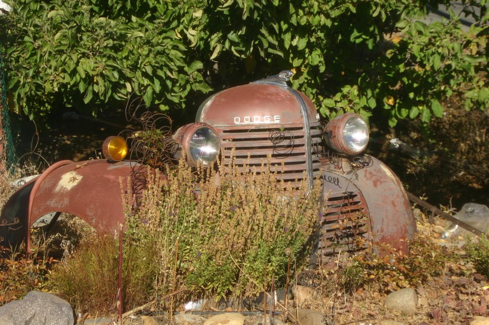
I found this piece of a vintage Dodge truck in Virginia City, NV. The town, like Skagway, has a history shrouded in precious metals - - both silver and gold. And, like the Klondike Gold Rush, also has a famous author tied into the history. Mark Twain started his writing career as a reporter for the (Virginia City) Territorial Enterprise. Today, the former newspaper office is a museum and there is also a Mark Twain Book store. The town's main street has a more rustic appeal than Skagway with casinos and T-shirt/souvenir shops, not jewelry stores, taking most of the attention.
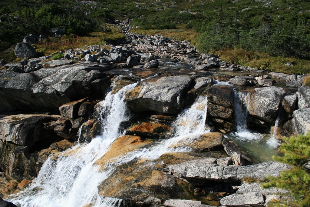
SOUTH LAKE TAHOE, CA, Oct. 12
Just a few miles outside South Lake Tahoe we stopped at a Bureau of Land Management-operated National Forest visitor center. One of the many nature trails led us through an area for bird watching and then to a stream where Kokanee salmon were spawning and the Morganser Ducks (above) were zipping around in formation stalking the fish.
The Kokanee is/are quite famous for (apparently) giving their name to a regional beer here on the Left Coast. Why you would name a beer after a fish is beyond my realm of info.
FYI: The Kokanee have it made. They spawn in nearby stream, the young (fry) swim to Lake Tahoe and then return 3-4 years later to start the circle again.

Wednesday, October 11, 2006

Crescent City Kitty

SOUTH LAKE TAHOE, CA, Oct. 11, 2006
While Lake Tahoe has many areas with docks around the lake this shot is from Crescent city, CA on Oct. 9. We had stopped to take a quick bagel and peanutbutter lunch break and encountered this friendly feline. Lydia had taken a walk to take a pic of the lighthouse there and this guy wandered up, walked across my lap and sat down. The body language was simple: I'm not really wild so pet me and take me home; better yet take me home and feed me. It was obvious from his manners that somebody had abandoned the coal-black critter. Too bad 'cause he had character.
No pics between Susanville, Reno, NV and Tahoe. Just wide open spaces with lots of brown grasses, pine trees and cattle/horses/alpacas/sheep. Tahoe got 6" of snow on Monday, which made the roads slick; there's still some in higher elevations around 6,000'

Tuesday, October 10, 2006

Catching up

SUSANVILLE, CA, Oct. 10
We've turned left from our trip down the Washington / Oregon / California coast and headed into the northern interior of California...sort of Paart Two of our journey back to FL.

Here are a couple of photos to sort of catch things up. until I/we find more that we overlooked the first time. The above pic is from the Redwood National Park area outside Eureka, CA. The pic doesn't really show how tight some of the passages between the trees and the narrowness of the road was.
We stayed in Cape Blanco State Park campground and went out to see the lighthouse at about 7:15am. That's the morning sun glistening off the lower left of the sign and the light (this is still a working light) shining thru the Fresnel lens

What we have here is a technical glitch which I can't (maybe) figure out how to fix. The two photos are supposed to be centered rather than side by side. Anyway the left (or top) pic is somewhere along the coast while the right (or bottom) shot of the driftwood and reflection in the tidal pool should be from Canon Beach near Seaside, OR

Cape Arago Lighthouse, Charleston, OR

Saturday, October 07, 2006

Making waves2

CAPE PERPETUA, OR
One more shot

Making waves

CAPE PERPETUA, OR
We missed all these sights yesterday due to lousy weather and low clouds. Cape Perpetua has plenty of trails along the ocean with tidal pools, blow holes, driftwood and other spectacular wave induced natural attractions.


Friday, October 06, 2006

Info


FLORENCE, OR
Click on the pic to get an easier size to read

Sunset

CAPE LOOKOUT (OR) STATE PARK, Oct. 4
I cheated and used a cross-hatch filter on the camera lens to get the 'star' look of the setting sun on the beach area at Cape Lookout. We were camped behind a sand dune nearby. It was comforting to know that they tested the Tsunami Warning sirens in the campground every other Monday of the month. Beautiful Oregon State Parks, great facilities and signs warning you that you are camped in a Tsunami Hazzard Area.
On the plus side, the warning signs say you have approximately 20 minutes from wailing sirens scaring the hell out of you before you should prepare to start swimming.

Wednesday, October 04, 2006

Axe me no questions


JOYCE, WA
Whiskey Creek Beach Campground

This double-headed axe looks quite menacing in the daylight, especially with that short handle. You ought to try it out in the dark, chopping big firewood into smaller pieces. You do this very, very carefully.

Check out lydiahinshaw.blogspot.com for her blog on our stay in a rustic camping cabin. This photo should give you an insight into 'the rest of the story.'

Tuesday, October 03, 2006

Stripes

SEASIDE, OR, 10.3.06
This well fed rascal is the guard kitty in one of the bookstores we wandered through on a walking tour of Seaside. A customer came in just as I was about to get a name for the above fur-ball and then I forgot the name of the store. Still, since the unnamed feline was up for a belly rub or two I decided to make, as the shop owner noted, " doesn't like to miss meals" slightly famous

Where else but on the Left Coast

OLYMPIC NATIONAL PARK (seashore), WA, 10.2.06
SEASIDE, OR, 10.3.06
Let's say you're on the beach checking out the driftwood, the rocks, the scenic views when suddenly you feel the ground shaking!! Wow! What should you do?? The states of Washington and Oregon..and maybe California too...have you covered. There are signs near the beaches to tell you that if the ground shakes and you are on the beach to: RUN LIKE HELL!! There are signposts like the one below directing you to Tsunami Evacuation Routes. There are information sheets posted inside rooms in hotels, motels (and the Hostel in Seaside, OR, where we are staying) with lots of good Tsunami info. The same goes for the campground we stayed in last night, which was on the ocean.
So, for those of you who see the glass half-empty or are an optimistic realist like I am -- then if you don't get caught in an avalanche of rocks and trees from above you can bet you'll sleep with the fishes if you don't get to high ground quick enough.
More dispatches to come from the Left Coast as the fun continues.

Monday, October 02, 2006

Safe refuge

SAN JUAN ISLAND, WA

The Bald Eagle perched on the National Wildlife Refuge sign has the perfect location to inspect the kayak-ers on the calm waters of xxxxx as they float by. However, he's more interested on what's going on in the waters on his side of the rocks.

Five months of trying to spot wild animals and birds on the Klondike Highway and surrounding areas wasn't wasted as we spotted this 'baldy' before we even pulled into the park's parking lot. We had rented a car in Friday Harbor, where the ferry docked, to tour the island.

Sunday, October 01, 2006

Book Club

DoubleEspresso Book Club selections:

"The Blue Bear" by Lynn Schooler. This is a very interesting book about friendship and Alaska. Despite the title sounding like a children's book, this is a real life true story.

"Shadow Divers" by Robert Kurson. This is the story of the discovery, in 1991, of a German submarine from WWII in an area off the New Jersey coast where there was no reported U-Boat activity. The obsession to discover the name of the sub and the identity of those aboard and bring closure to the men's families takes nearly 10 years. Another true life tale.

Time for coffee

We're sitting in the aptly-named (for Florida residents) Hurricane Coffee Company in Sequim, Washington. There's another coffee shop across the street and down a-ways, just as I'm sure there is another coffee-shop drive-thru within a mile or two. It's kind of like dying and going to coffee heaven. If I don't pace myself in coffee nirvana I could be wired until we're two states away. I'm quite sure that Oregon - - where we're headed next - - will have almost as many java joints.

Thursday, September 28, 2006

FRASER RIVER VALLEY, BETWEEN QUESNEL AND HOPE, BC
I really wanted to use a dateline listing the towns of Likely and Horsefly but that would have required a 60 mile round trip to check them out. Anyway, the drive from Quesnel to Hope along CA97 parallels the Fraser River Valley and is quite spectacular, especially in sunlight.
The Big Horn Sheep - - and a couple of friends - - spotted us as we headed south. The train shot was taken from a rest area along the road. One nice thing is that on CA97 you have plenty of pull-outs from which to shoot spectacular scenery AND passing lanes every two miles or so. Since the road is very up and down plus quite twisty and the main industry around here is lumber you need to zip around the much slower trucks.
But back to the railroad shot. It seems back in the 1800's when railroad building was the 'in thing' that two competing rail companies built tracks on opposite sides of the river. We actually had trains running in both directions when the shot was taken.
Spending time in a coffee shop in Hope, BC before heading to and across the US border into Washington State and the Pacific Coast Highway.


Wednesday, September 27, 2006

FYI

QUESNEL, BC
We seldom, if ever, have a Big Mac Attack...unless the McDonalds has a billboard sign on the highway advertising free wi-fi. So, for the price of 2 coffees (yes, we're seniors, thank you) we got the net and you're reading the outcome. By the way the town we're in is pronounced Kweh-nell regardless of how it is spelled. Cheers.

Monday, September 25, 2006

SHINE A LIGHT ON THE BEAR, NOTES

ON THE INSIDE PASSAGE HEADING TO PRINCE RUPERT, BC
Want to get away from it all?? This lighthouse perched on a rock outcropping somewhere within the Canadian portion of the Inside Passage offers those with a solitary bent the perfect way to spend some time. No neighbors and not much else; maybe not even a way to get off as the boat in the far right of the picture is partially sunk although anchored to what appears to be a dock. ***click on the pic to enlarge it

I've enhanced the colors a bit to make things more recognizeable as this was taken under very foggy conditions, a strong wind and blowing rain.

(BELOW)
The black bear youngster below was out foraging in the grass alongside the Yellowhead Highway as we drove from Prince Rupert, BC to Smithers. It's raining so his/her coat is wet and matted but with a bear this young and no momma bear around we believe that the cub has no one to take care of it. Normally, young cubs spend at least two years with their mother learning how to hunt and survive. This shot was taken as the cub made its way across the highway; fortunately the driver of the lumber truck coming up behind us saw the cub and stopped until it got across and into the bushes. ***Click on the pic and take a look at it full sized.
Today (Monday, 9/25) we're creating blogs from the Smithers Guest House / Hostel in Smithers, BC. Last night it was blog-away from the Black Rock Rooster Hostel in Prince Rupert. We're not sure where we will be tomorrow night but if the rain continues it will be someplace warm and dry rather than a campground.
FANTAIL TRAIL OVERLOOK, KLONDIKE HWY.
One last (maybe) shot of the spectacular scenery along the Gold Rush route we drove almost every day. This shot, with fresh snow on the mountain in the center and swriling storm clouds, is/was a hint to those still in Skagway for the summer that it was time to go. It was taken on Thursday, Sept. 21, my final day of work.
Also interesting to note are some the pine trees which have only limbs basically pointing south. The reason?? The winter winds which blow out of the north at up to 50mph taking temperatures in mid-winter to -30 below literally freeze the sap in the trunks and 'kill' the growth of the branches .

Tough job

ABOARD THE MV TAKU HEADING INTO KETCHIKAN, AK
SUNDAY, SEPTEMBER 24. It's hard to believe right now, but we've escaped the cluthes of Skagway....but not the weather. The summer job is over; the next journey begins. Two nights and nearly two days on the Alaska Ferry System boat MV Taku has allowed us to wind down a bit and watch the rain, fog and low clouds from a dry and warm seat on the main observation deck. For exercise there were forays outside onto the rain and windswept deck to shoot photos of whale fins and whale tails but no 'whole' whales and the occassional lighthouse. The next best "hobby" was watching the unfortunate individuals who drew watch duty at the head of the boat when we headed into the harbors for docking and off-load / on-load of passengers and cars.
The individual in yellow didn't take his eyes off the churning waves on this one hour shift as we headed into Ketchikan, AK...and in a 30mph headwind with stinging rain this could not have been a fun job. Of course, this individual might have been low man on the totempole or a goof up. In any case, there were enough harbors to keep a number of these folks busy.
And just when you thought the ship had everything you needed, the cook in the cafeteria would break out into his Elvis personation and then practice between work shifts with a karioke machine. Free at last, free at last

Saturday, September 16, 2006

Sunny Day

WHITE PASS, JUST INSIDE THE CANADIAN BORDER, Saturday, Sept. 16
My gosh, a sunny day. Actually the third sunny day in a row. Things are winding up in Skagway so it figures that we would get some good weather. I asked a Border Guard at Canadian Customs about what it would have been like to have about three months of this weather. His answer: "We probably would have spent a lot of time peering through the smoke from forest fires. So, I guess the gloomy weather through what took the place of the summer months does have an upside.
How friendly are the folks of Skagway?? A wedding invitation posted on the door of the Post Office invited the entire town to the ceremony and reception afterward for a couple from town.
The top photo is from one of the pull-off areas just past the summit of White Pass. This is an area we've been looking at for some time as there is a trail - - vaguely recognizable in the center of the pic at the bottom of the small cliff we're looking down from.
The bottom photo is of one of the waterfalls along the trail. It winds alongside this melt-water stream all the way (we guess since we didn't go more than halfway up) to the top of a ridge from where you can see - - more mountains.
Our favorite coffee shop, Haven Cafe, is closing today so we are spending the late afternoon on our computers. There are "Sale" signs in most of the shops on Broadway, which is the main street in Skagway. Bargains galore if you need T-shirts, hats, jackets, and lots of other things which fall into the classification of souvineers asnd are mostly tacky.


Foggy times on the trail

MONTANA MOUNTAIN RIDGE NEAR BIG THING MINE, Carcross, YT
Last week, and for nearly the last 15 years, whenever we hike I am designated SHERPA - - the one who trudges along with the backpack, takes pictures and carries energy bars or Snickers as the GUIDE hustles along ahead on the trail.
Here, with three trusty companions checking out three different directions, the GUIDE takes a moment to try and figure out if we've gone far enough up the trail and are cold and soaked enough to turn back. Sorry, but the command is "onward and upward."
As noted in an earlier Blog, I always think about how to get back while the GUIDE is thinking that if we hike high enough we may get above the clouds and who knows what might be there.
Anyway, I liked the picture and the patience of our friends' 'trusty friends' (left to right) Fibber McGee, LocoBones and Dingo.

Saturday, September 09, 2006

The long and winding road

SKAGWAY, AK, Sept. 9
Views like this one of the Klondike Highway heading towards Skagway and the Pacific Coast Range mountains separating Alaska and Canada will be a vision of the past soon. This portion of the highway is one we (LH and I) drive nearly every time we do tours - - very familiar and very spectacular. It's one we'll miss as the days wind down and our 'servitude' in Skagway comes to an end.
Unless Florida has grown a mountain range with 7,000' peaks and glaciers, we will only be able to recall scenes like this from memory backed up by the photos we've taken.
Since we stayed in Skagway to watch the rain instead of camping out in Whitehorse, we've spent most of Saturday sitting in Haven Cafe (7 blocks from our cabin) with a lot of other summer time refugees working on the internet, reading, chatting and drinking coffee.

Sunday, September 03, 2006

Snow and fish

CHILKAT EAGLE PRESERVE, Klukwan, AK, Sept. 2, 2006
This Imature Eagle (young, about 2-3 years old since he is only mottled white) is keeping an eye on two First Nations (Tlingit Indian Nation) individuals in a row boat just below the tree he is in. They were netting salmon and he was looking for easy pickings. In November, about 3-4,000 eagles show up along the river in this eagle preserve.


HAINES JUNCTION, YT., Sept. 3, 2006
Fresh snow on the St. Elias Mountains north of Haines Junction. The mt. range is in Kluane National Park. We've already seen light dusting on mtns. near Skagway, but this snow is letting everyone in the area know that winter isn't far off. There were mountains with a much heavier covering, but when we got outside from breakfast the clouds had dropped down to obscure the 10-14,000 peaks.


Friday, September 01, 2006

Time Change

SKAGWAY, AK, SEPTEMBER 1
We went out to breakfast this morning which is what we usually do on Friday to celebrate the end of another week. There was a sign up in our favorite cafe: "The End Is Near....26" This wasn't a biblical reference but one which meant that the last cruise ship docks in Skagway on Sept. 26.
It was almost as if a different feeling is not sweeping town with the end of the season growing near but nobody dared talk about things until September rolled around. Now conversations begin with: "How many days to you have left" or, more to the point, "When are you leaving" The jobs which seemed never-ending are now russing to conclusion. People share sympathy with those who will be left behind to clean up, lock up and turn out the lights when the last tourist leaves.
After two days of solid rain the sign in the cafe might well be a warning to build your ark now while you have time...as the forecast for the next 5 to 7 days doesn't look much better

Sunday, August 27, 2006

Sunny Day in Whitehorse

SCHWATKA LAKE, WHITEHORSE, YT
Things to do if you've got a bit of extra money to spend on a sunny day in Whitehorse

Correction

WHITEHORSE, YT, August 27
OOPS! The fine looking fellow in the photo above is named Hobbes - - from the (no longer published) "Calvin and Hobbes" comic strip. Now since the Hobbes in the strip was a stuffed tiger the relationship must be more to the frenetic and deep thinking Calvin, who never met mischief he couldn't figure a way to get into.
Additionally, if you've followed Lydia's blog you'll know that the original posting showed up on her site as a feline named Hops..blame the mistake on too many years in motorsports to always hear and understand what others are saying although this can come in handy some times as an excuse

Saturday, August 26, 2006

Friends along the trail

(Above) This Malmute / Samoyed mix greeted us at the Salmon Fish Ladder in Whitehorse. He had a Samoyed companion as a playmate. (Middle) This guy is named LocoBones and he's the companion of a couple of friends who work at Carribou Crossing which is an attraction on one of our tours. (Bottom) The ledgend goes that when the fireweed starts to get this white/cotten-ish cover - - after it's regular fushia-colored blooms have fallen off - - that winter is on the way. Since we've seen leaves turning color for the past two weeks we tend to believe in the forecast.

Foggy Days

On the Klondike Highway heading to White Pass, August 24
It's 1pm on another bright and sunny day in Skagway. Oops. Well the sun is probably shining somewhere but it sure isn't in Skagway. So what we have here is the view from the driver's seat in the tour bus I'm driving up the mountain at about 20mph. It's real quiet inside because in conditions like this nobody talks much....including me. Except to point out that we may be fools BUT the Cruise Ship Sheep in the van pulling that load of bicycles in front of us really have a few screws loose because they paid for an adventure and are going to ride down the mountain in this fog. This is not something avid cyclists who are knowlegable would do "for fun" but then we don't go on cruises either. And to make it more fun for all I have to dodge around these folks.
Unfortunately, this has been typical of weather near the top of the White Pass. South winds off the Lynn Canal blow the low cloud cover against the mountains and we ending up driving by braile.
Note the post hanging out over the side of the road. These are warning devices for the snowplow / snowblower drivers. The vehicles have spotlights on top of the cab and the lighter portion of the bar reflects light telling the driver he is at least still on the road. If the light hits the red portion then things could be getting a bit 'iffy' because they are either close to the rock wall or the guardrails - - and looking at the guardrails lining the road you can see they are beaten and banged up. Now if you make a big mistake on the guardrail side you could end up about 300' below and that's a long climb back up .... if you survive.
The other point to consider is that in December and January it starts getting light around 10am and the darkness drops at 3pm. The road is a 365 day road because of the fuel depot and container cargo facilities in Skagway which deliver fuel and goods into Canada.